
“With AvoMap, we’ve added stunning 3D previews of our race courses — not just helpful for runners prepping before race day, but also a game-changer for our live briefings on-site. If you're a race organizer looking to give participants a clearer, more immersive course overview, we highly recommend it.”
L'alternativa a Mult.dev con pieno controllo creativo
Entrambi trasformano i viaggi in video con mappe animate. La differenza sta in quanto del risultato puoi plasmare tu: AvoMap offre terreno 3D reale, controllo di camera e tempi per ogni segmento e un editor gratuito senza abbonamento — paghi solo quando esporti.
In breve
Mult.dev è ottimo per animazioni città-per-città rapide e stilizzate, con configurazione minima. AvoMap è fatto per chi vuole che il video somigli al proprio viaggio: disegna i percorsi su terreno 3D reale, importa esattamente le tracce GPX/KML, anima i voli su un globo e ti lascia dirigere camera, ritmo, colori, marker e logo per ogni segmento. Nessuno dei due richiede un abbonamento; l'editor di AvoMap è gratuito senza limiti e i crediti si spendono solo all'export.
Da Mult.dev ad AvoMap in tre passi
- Apri l'editor
tutte le funzioni sono sbloccate dal primo clic e l'anteprima non costa nulla.
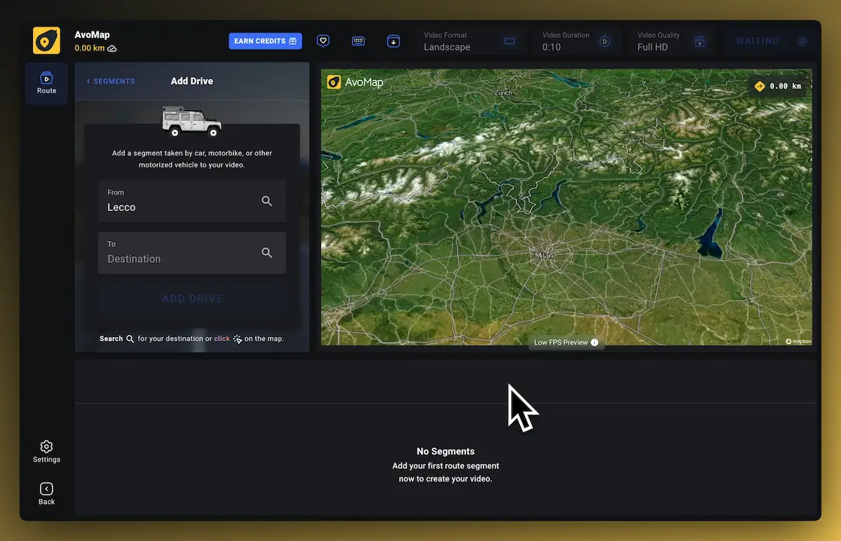
- Ricrea il tuo percorso
imposta partenza e arrivo per ogni segmento come sei abituato, oppure salta il passaggio importando un file GPX/KML.
- Anteprima subito, export quando vuoi
l'anteprima resta gratuita per sempre; un video finito in 1080p costa un credito di rendering, in 4K due.

AvoMap vs Mult.dev
| Funzione | Mult.dev | |
|---|---|---|
| PrezziPrezzi semplici che crescono con il tuo progetto. Niente abbonamenti, costi nascosti o sorprese. | Da 9 $ per 5 video | Da 5,99 $ per 5 video |
| Abbonamento mensileCon AvoMap paghi solo i video che renderizzi — nessun abbonamento, nessun costo nascosto. | ✕ | ✕ |
| Stili di mappaSette mappe base, dal terreno satellitare alla mappa scura essenziale, ognuna con luce di alba, giorno, tramonto o notte. | 7 stili di mappa × 4 ambienti di luce | 2 stili di mappa |
| Etichette e marker illimitatiAggiungi tutti i POI, marker o simboli che vuoi — senza limiti. | ✓ | ✕ |
| Controllo completo dell'animazionePosiziona la camera come preferisci, per ogni segmento — angolo, altezza e velocità sono tuoi. | ✓ | ✕ |
| Colori personalizzatiScegli da un'ampia gamma di colori, in linea con il tuo stile. | ✓ | ✓ |
| Controllo della durataVideo breve e diretto o dettagliato — decidi tu, segmento per segmento. | ✓ | ✕ |
| Importa .gpx e .kmlHai già una traccia registrata? Importala e guarda la tua avventura in pochi secondi. | ✓ | ✓ |
| Profilo altimetricoUn grafico altimetrico animato, calcolato all'istante. | ✓ | ✕ |
| Prova gratis, senza carta di creditoUsa l'editor quanto vuoi; ogni export costa 1 credito di rendering. Tutto qui. | ✓ | ✓ |
Un terreno che racconta la storia
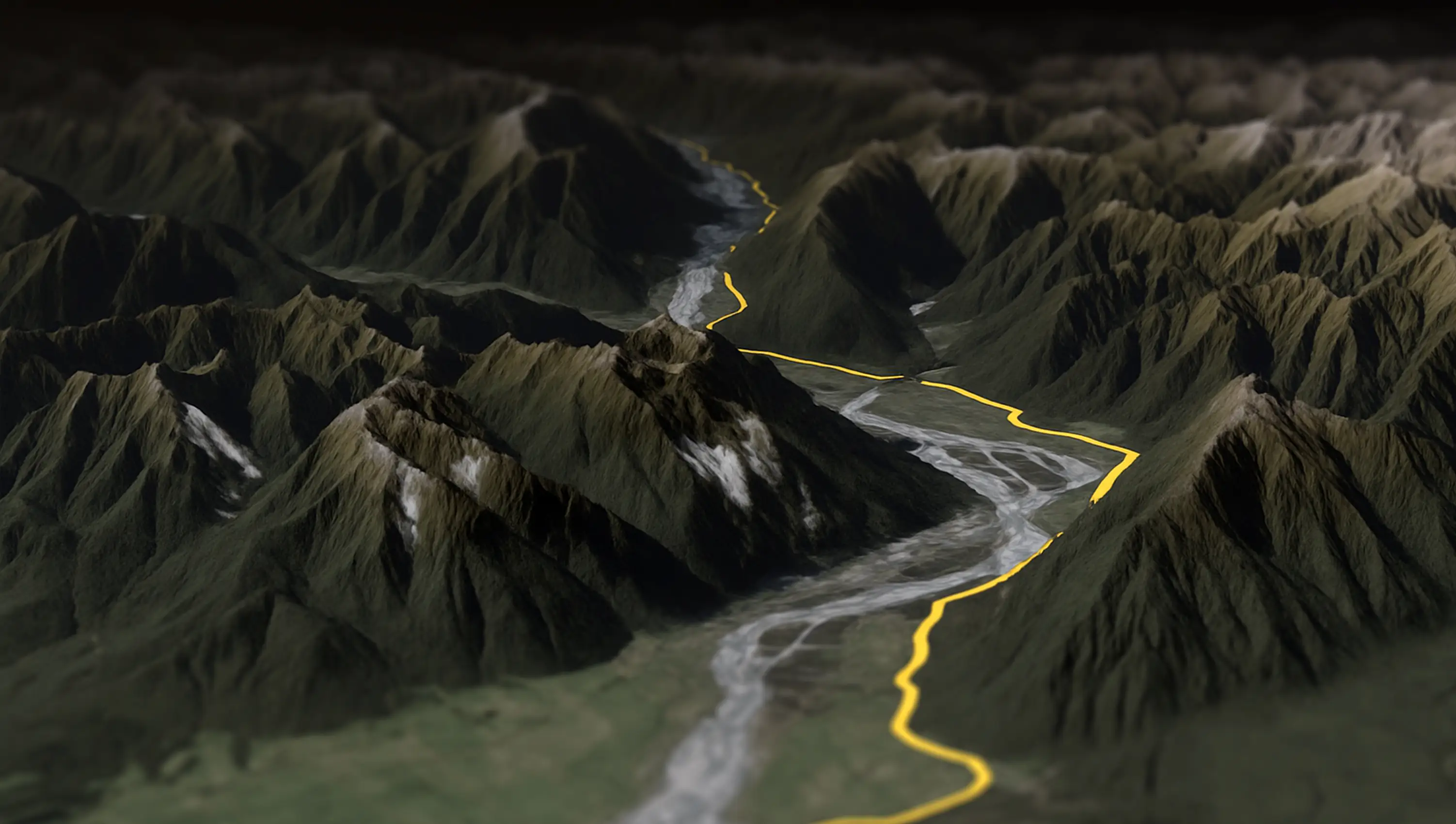
Un passo di montagna deve sembrare un passo di montagna. AvoMap renderizza il tuo percorso su altimetrie e immagini satellitari reali: il video porta con sé la drammaticità del paesaggio vero, e la camera dinamica lo sorvola come una ripresa col drone.

Dove Mult.dev brilla
Scrivi le città in ordine, scegli il mezzo, premi crea — il flusso zero-config di Mult.dev è davvero rapido per semplici animazioni punto-a-punto. Se ti basta questo, è un buon tool.
Dove AvoMap va oltre
- Percorsi veri, terreno vero. Importa la traccia GPX/KML esatta di un trekking, una pedalata o un viaggio in auto e guardala animarsi sul terreno satellitare 3D — non una linea stilizzata tra due città.
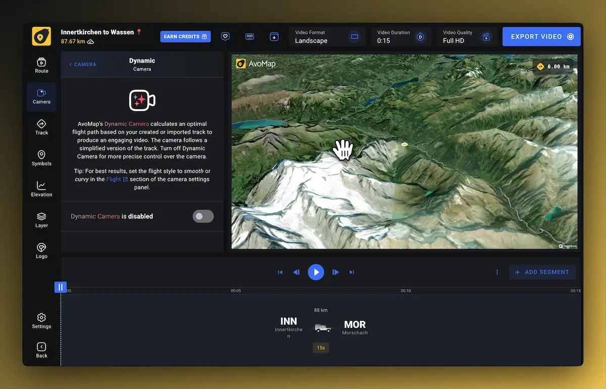
- Dirigi la camera. Durata, angolo e altezza per ogni segmento; una camera dinamica che segue il percorso; voli di apertura e chiusura personalizzati.
- Rendilo tuo. 7 stili di mappa con 4 ambienti di luce, 22 colori, oltre 100 marker predefiniti, simboli personalizzati, un profilo altimetrico animato — e il tuo logo al posto del nostro.
Join Thousands Of Happy Users
See what some of them have to say about AvoMap
“I run a YouTube channel focused on trail running. For our Live Race Briefings, AvoMap helps me present race maps exactly how I want. It’s the perfect tool to bring my ideas to life as a content creator.”
“Avomap is a fantastic tool with an incredible range of options for preparing a route in a unique and exciting way. This makes cross-country runs truly enjoyable!”
“I discovered AvoMap by chance when searching for a way to create a professional route map for a local 10K and Half Marathon event. Not only was I able to display the route in a polished video, but I was also able to add notable markers, and display the elevation on screen. My client is delighted, and I'll definitely use the service again in the future.”
“I have searched through a number of tools on the Internet to be able to visualize the routes of my road trips and vacations. None of the tools are as good as AvoMap, and it is improved almost weekly. You can really see the attention to detail in every feature.”
“An extremely user-friendly and intuitive tool, and of highest quality mapping and imaging I've seen! I use it regularly to visualise my hikes and treks in many videos I produce for my YouTube channel. It is a tool that meets all of my YouTube channel's needs.”
“Work has taken me all over the world and ignited my interest in documenting my travels. AvoMap provides me a beautiful way to see my journey and remind me of the many beautiful places I have seen.”
“AvoMap was incredibly easy to use — the learning curve was almost non-existent. Within minutes, I understood how everything worked, and just a bit later, I had a beautiful map video ready to go.”
“AvoMap is the perfect tool for promoting our trail races in Tây Giang, in the highlands of Vietnam. The videos bring our routes to life and help attract more runners to the region. Super easy to use and effective!”
“I’ve always enjoyed using tools like Felt.com to plan and mark up my trips — but I wanted something more immersive. AvoMap delivers exactly that, with stunning 3D maps and smooth animations that bring my journeys to life.”
“AvoMap has been a game-changer for my YouTube channel! It's easy to use, delivers high-quality videos fast, and offers great customization. Whether uploading GPS files or creating routes from scratch, it's the perfect tool for content creators — no tech skills needed.”
“I’ve been using AvoMap since 2024 to document my bikepacking journeys and create YouTube videos. The editing tools are the best I’ve found for customizing the fly-throughs I want to share, and the 4K render quality is beautiful. Plus, the AvoMap team is incredibly responsive to support questions and open to new ideas.”
Import your GPS data from top brands
AvoMap works seamlessly with all your favorite platforms. Just export your adventures and bring them to life with stunning animations in seconds.
FAQ sull'alternativa a Mult.dev
AvoMap è davvero gratuito?
L'editor è gratuito con tutte le funzioni sbloccate: percorsi, stili, camera, marker, anteprima istantanea. Paghi solo quando esporti un video finito, con crediti a partire da 9 $ per 5 video. Non c'è abbonamento.
Posso importare percorsi come su Mult.dev?
Sì, e di più: costruisci percorsi segmento per segmento (auto, aereo, bici, a piedi) oppure importa la traccia GPX/KML esatta da Strava, Garmin, Komoot, AllTrails o qualsiasi dispositivo GPS.
AvoMap anima anche i voli?
Sì — i voli si animano come rotte ortodromiche su un globo 3D realistico, con 7.695 aeroporti disponibili, e si combinano con viaggi in auto, pedalate e camminate in un unico video.
Con che qualità esporto?
I video finiti si renderizzano in 1080p o 4K a 60 fotogrammi al secondo, nei formati per YouTube, Reel, Storie e TikTok.
Posso togliere il logo AvoMap dal mio video?
Sì — sostituiscilo con il tuo logo o marchio, posizionandolo e scalandolo liberamente. Il white-label è integrato.
Stai confrontando altri tool? Guarda come se la cava AvoMap contro TravelBoast, TravelAnimator, PictraMap & Rumbo.
Videos Made With AvoMap
Explore the full range of AvoMap features in action with these videos, all created using the easy-to-use editor.
Splügen Pass to Italy 🇮🇹
The Splügen Pass connects Switzerland and Italy, linking Splügen with Chiavenna. At 2,113 meters (6,929 feet), it provides a direct route through the Alps, offering impressive views of the surrounding mountains and valleys.
Ride Through The Desert — Chile
Taking a motorcycle trip through the Chilean desert, starting from Combarbala and heading to La Serena on the coast.
UTMB Eiger Ultra 2024
With a distance of 101 km and an elevation gain of 6,700 meters, the Eiger Ultra 101 is a tough challenge for even the most seasoned trail runners. The route includes stunning viewpoints such as Grosse Scheidegg, First, Bachalpsee, Berghotel Faulhorn, Schynige Platte, Wengen, Männlichen, and the base of the legendary Eiger North Face.
Otter Trail — South Africa
The Otter Trail is a five-day hiking route in South Africa, starting at Storms River Mouth Rest Camp and finishing at the small resort village of Natures Valley in the de Vasselot section of the park.
Kepler Track — New Zealand
The Kepler Track is one of New Zealand's Great Walks, renowned for its stunning natural beauty and varied landscapes. It's a 60-kilometer (37-mile) circular hiking trail located in Fiordland National Park on the South Island of New Zealand. The track typically takes around 3 to 4 days to complete and passes through diverse terrain, including beech forests, alpine meadows, and alongside pristine lakes and rivers.
170 Miles Around Lake Tahoe
The Tahoe Rim Trail is a 170-mile long hiking path encircling the Lake Tahoe Basin in the Sierra Nevada, traversing parts of Nevada and California in the United States. It spans elevations from 6,223 feet at Lake Tahoe's outlet to 10,338 feet at Nevada's Relay Peak.
The Grand Raid — La Reunion
The Grand Raid de la Réunion, known as La diagonale des fous, is an ultramarathon held annually in October on Réunion island, a French overseas department located in the Indian Ocean between Madagascar and Mauritius.
Frankfurt To Dubai In 30 Seconds
As a break from my usual routine, I decided to embark on an epic journey by motorbike from Frankfurt to Dubai. It took me 62 days to complete the trip, and along the way I crossed through 11 different countries including France, Switzerland, Italy, Greece, Albania, North Macedonia, Bulgaria, Turkey, Georgia, Armenia and Iran.
Zugspitze Ultra — Germany
The Zugspitz Ultratrail stands as Germany's premier trail running event. Drawing over 4400 participants, it features six distinct routes spanning from 16 to 106 kilometers in length.
San Francisco Marathon
The San Francisco Marathon is a renowned race featuring a full marathon, half marathon, and 5K. Held in late July, it navigates iconic landmarks like the Golden Gate Bridge and Fisherman's Wharf. The hilly terrain presents a challenge, but the stunning views and community support make it memorable.
Prova la differenza sul tuo prossimo viaggio
Editor gratuito, tutte le funzioni sbloccate, nessun abbonamento. Paghi solo all'export.