
La alternativa a Mult.dev con control creativo total

Ambas herramientas convierten viajes en vídeos de mapas animados. La diferencia está en cuánto del resultado puedes moldear tú: AvoMap ofrece terreno 3D real, control de cámara y tiempos por segmento y un editor gratuito sin suscripción — solo pagas al exportar.

No monthly subscriptionNo hidden feesTry for free

La versión corta

Mult.dev es genial para animaciones rápidas y estilizadas de ciudad a ciudad, con configuración mínima. AvoMap está hecho para quienes quieren que el vídeo se parezca a su viaje: dibuja las rutas sobre terreno 3D real, importa las trazas GPX/KML tal cual, anima vuelos sobre un globo y te deja dirigir cámara, ritmo, colores, marcadores y logo por segmento. Ninguna de las dos exige suscripción; el editor de AvoMap es gratis sin límites y los créditos solo se gastan al exportar.

01Cambiar lleva minutos

De Mult.dev a AvoMap en tres pasos

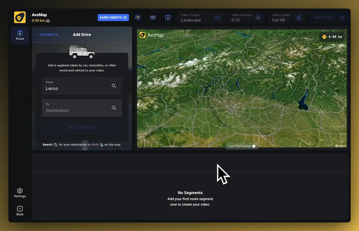
  1. Abre el editor

    todas las funciones están desbloqueadas desde el primer clic y la vista previa no cuesta nada.

  2. Recrea tu ruta

    define origen y destino por segmento como estás acostumbrado, o adelanta trabajo importando un archivo GPX/KML.

  3. Vista previa al instante, exporta cuando quieras

    la vista previa es gratis para siempre; un vídeo final en 1080p cuesta un crédito de render, en 4K dos.

02Función por función

AvoMap vs Mult.dev

FunciónAvoMapMult.dev
PreciosPrecios simples que crecen con tu proyecto. Sin suscripciones, costes ocultos ni sorpresas.Desde
9 $ por 5 vídeos
Desde
5,99 $ por 5 vídeos
Suscripción mensualCon AvoMap solo pagas los vídeos que renderizas — sin suscripción ni costes ocultos.
Estilos de mapaSiete mapas base, del terreno satelital al mapa oscuro sencillo, cada uno con luz de amanecer, día, atardecer o noche.7 estilos de mapa × 4 ambientes de luz2 estilos de mapa
Etiquetas y marcadores ilimitadosAñade todos los POI, marcadores o símbolos que quieras — sin límite.
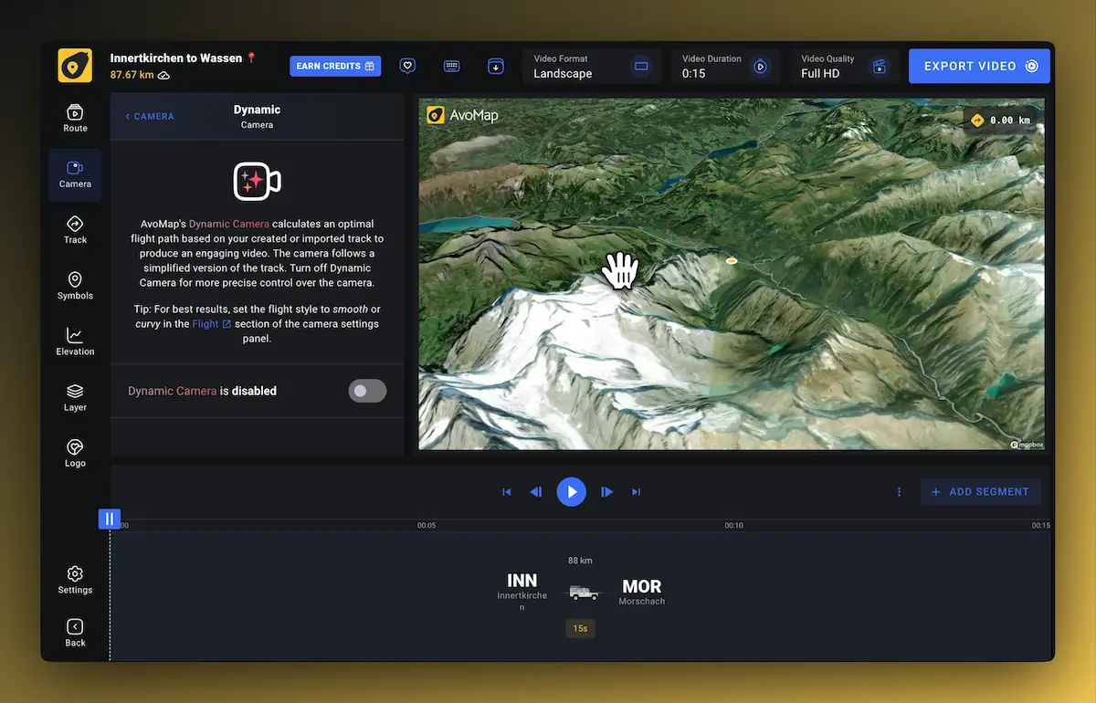
Control total de la animaciónColoca la cámara como quieras, por segmento — ángulo, altura y velocidad son tuyos.
Colores personalizadosElige entre una amplia gama de colores para que encaje con tu estilo.
Control de duraciónUn clip corto y directo o un vídeo detallado — tú decides, por segmento.
Importar .gpx y .kml¿Ya tienes una ruta grabada? Impórtala y visualiza tu aventura en segundos.
Perfil de elevaciónUn gráfico de altitud animado, calculado al instante.
Prueba gratis, sin tarjetaUsa el editor todo el tiempo que quieras; cada exportación cuesta 1 crédito de render. Eso es todo.
03Mira la diferencia

Un terreno que cuenta la historia

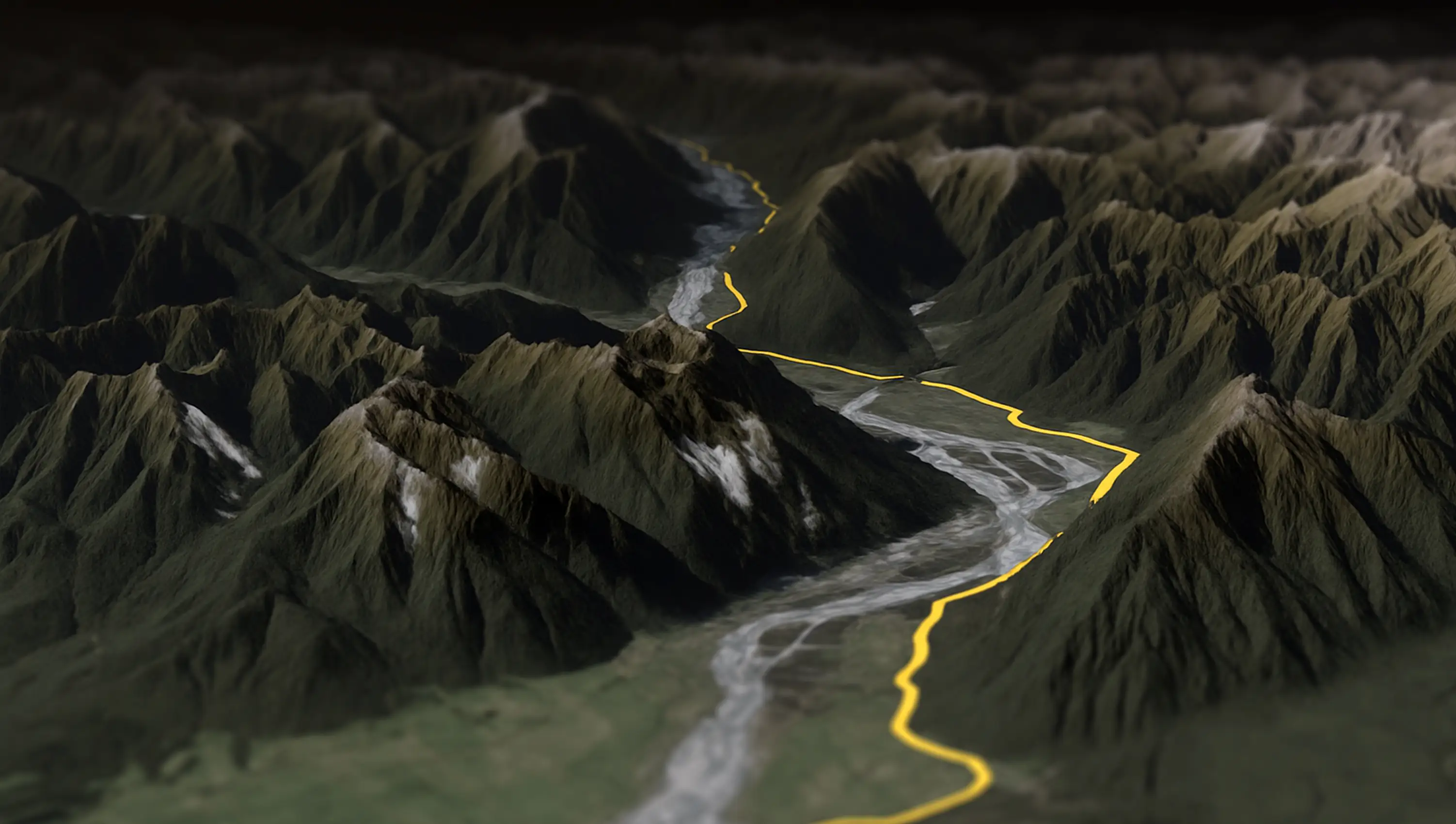
Un puerto de montaña debe parecer un puerto de montaña. AvoMap renderiza tu ruta sobre elevaciones e imágenes satelitales reales: el vídeo conserva el dramatismo del paisaje de verdad, y la cámara dinámica lo sobrevuela como un dron.

Descubre el animated map maker

Donde Mult.dev brilla

Escribe tus ciudades en orden, elige cómo viajaste, pulsa crear — el flujo sin configuración de Mult.dev es realmente rápido para animaciones simples de punto a punto. Si eso es todo lo que necesitas, es una buena herramienta.

Donde AvoMap va más allá

  • Rutas reales, terreno real. Importa la traza GPX/KML exacta de una caminata, una salida en bici o un viaje en coche y mírala animarse sobre terreno satelital 3D — no una línea estilizada entre ciudades.
  • Dirige la cámara. Duración, ángulo y altura por segmento; una cámara dinámica que sigue la ruta; vuelos de entrada y salida personalizados.
  • Hazlo tuyo. 7 estilos de mapa con 4 ambientes de luz, 22 colores, más de 100 marcadores predefinidos, tus propios símbolos, un perfil de elevación animado — y tu logo en lugar del nuestro.
Testimonials

Join Thousands Of Happy Users

See what some of them have to say about AvoMap

“With AvoMap, we’ve added stunning 3D previews of our race courses — not just helpful for runners prepping before race day, but also a game-changer for our live briefings on-site. If you're a race organizer looking to give participants a clearer, more immersive course overview, we highly recommend it.

David LloydRace Director at Vietnam Trail Series

“I run a YouTube channel focused on trail running. For our Live Race Briefings, AvoMap helps me present race maps exactly how I want. It’s the perfect tool to bring my ideas to life as a content creator.”

Nick ThomaidisContent Creator & Trail Runner

“Avomap is a fantastic tool with an incredible range of options for preparing a route in a unique and exciting way. This makes cross-country runs truly enjoyable!”

Stefan SchwenkeHead of Media at Alpen Challenge Lenzerheide

“I discovered AvoMap by chance when searching for a way to create a professional route map for a local 10K and Half Marathon event. Not only was I able to display the route in a polished video, but I was also able to add notable markers, and display the elevation on screen. My client is delighted, and I'll definitely use the service again in the future.

Lauren PenmanCopywriting & Creative Social Media Marketing

“I have searched through a number of tools on the Internet to be able to visualize the routes of my road trips and vacations. None of the tools are as good as AvoMap, and it is improved almost weekly. You can really see the attention to detail in every feature.”

Jan SchöpkeTravel Enthusiast & Power User

An extremely user-friendly and intuitive tool, and of highest quality mapping and imaging I've seen! I use it regularly to visualise my hikes and treks in many videos I produce for my YouTube channel. It is a tool that meets all of my YouTube channel's needs.”

Kamil TrzebiatowskiVideo content creator at Wandering Cloud

“Work has taken me all over the world and ignited my interest in documenting my travels. AvoMap provides me a beautiful way to see my journey and remind me of the many beautiful places I have seen.

Steven WhiteTravel Documentarian & Visual Storyteller

AvoMap was incredibly easy to use — the learning curve was almost non-existent. Within minutes, I understood how everything worked, and just a bit later, I had a beautiful map video ready to go.”

JJaskiVisual Storyteller & Travel Enthusiast

“AvoMap is the perfect tool for promoting our trail races in Tây Giang, in the highlands of Vietnam. The videos bring our routes to life and help attract more runners to the region. Super easy to use and effective!

Võ Đức LongRace Director at K'Lang Jungle Summit

“I’ve always enjoyed using tools like Felt.com to plan and mark up my trips — but I wanted something more immersive. AvoMap delivers exactly that, with stunning 3D maps and smooth animations that bring my journeys to life.”

Vrushank VyasVisual Storyteller & Travel Enthusiast

“AvoMap has been a game-changer for my YouTube channel! It's easy to use, delivers high-quality videos fast, and offers great customization. Whether uploading GPS files or creating routes from scratch, it's the perfect tool for content creators — no tech skills needed.”

ChiaraVideo content creator at
Moving Potatoes

“I’ve been using AvoMap since 2024 to document my bikepacking journeys and create YouTube videos. The editing tools are the best I’ve found for customizing the fly-throughs I want to share, and the 4K render quality is beautiful. Plus, the AvoMap team is incredibly responsive to support questions and open to new ideas.”

Crispin HoultVisual Storyteller & Travel Enthusiast

Import your GPS data from top brands

AvoMap works seamlessly with all your favorite platforms. Just export your adventures and bring them to life with stunning animations in seconds.

alltrails logoapplefitness logofitbit logogarmin logokomoot logorunkeeper logorunna logostrava logowikiloc logo
Preguntas

FAQ sobre la alternativa a Mult.dev

¿AvoMap es gratis de verdad?

El editor es gratuito con todas las funciones desbloqueadas: rutas, estilos, cámara, marcadores, vista previa instantánea. Solo pagas al exportar un vídeo final, con créditos desde 9 $ por 5 vídeos. No hay suscripción.

¿Puedo importar rutas como en Mult.dev?

Sí, y más: construye rutas segmento a segmento (coche, avión, bici, a pie) o importa la traza GPX/KML exacta desde Strava, Garmin, Komoot, AllTrails o cualquier dispositivo GPS.

¿AvoMap también anima vuelos?

Sí — los vuelos se animan como rutas ortodrómicas sobre un globo 3D realista, con 7.695 aeropuertos disponibles, y se combinan con trayectos en coche, bici y a pie en un solo vídeo.

¿Con qué calidad exporto?

Los vídeos finales se renderizan en 1080p o 4K a 60 fotogramas por segundo, en formatos para YouTube, Reels, Stories y TikTok.

¿Puedo quitar el logo de AvoMap de mi vídeo?

Sí — sustitúyelo por tu propio logo o marca, con posición y tamaño libres. El white-label viene incluido.

¿Comparando más herramientas? Mira cómo queda AvoMap frente a TravelBoast, TravelAnimator, PictraMap & Rumbo.

Videos Made With AvoMap

Explore the full range of AvoMap features in action with these videos, all created using the easy-to-use editor.

See all videos
Motorcycling · Mountain Pass · Switzerland · Italy

Splügen Pass to Italy 🇮🇹

The Splügen Pass connects Switzerland and Italy, linking Splügen with Chiavenna. At 2,113 meters (6,929 feet), it provides a direct route through the Alps, offering impressive views of the surrounding mountains and valleys.

Desert · Ocean view · Nature · Extreme

Ride Through The Desert — Chile

Taking a motorcycle trip through the Chilean desert, starting from Combarbala and heading to La Serena on the coast.

Trail Run · Ultra · Mountains · Nature

UTMB Eiger Ultra 2024

With a distance of 101 km and an elevation gain of 6,700 meters, the Eiger Ultra 101 is a tough challenge for even the most seasoned trail runners. The route includes stunning viewpoints such as Grosse Scheidegg, First, Bachalpsee, Berghotel Faulhorn, Schynige Platte, Wengen, Männlichen, and the base of the legendary Eiger North Face.

Beach · Vineyards · Forest · Ocean view

Otter Trail — South Africa

The Otter Trail is a five-day hiking route in South Africa, starting at Storms River Mouth Rest Camp and finishing at the small resort village of Natures Valley in the de Vasselot section of the park.

Trail Run · Mountains · Forest · Nature

Kepler Track — New Zealand

The Kepler Track is one of New Zealand's Great Walks, renowned for its stunning natural beauty and varied landscapes. It's a 60-kilometer (37-mile) circular hiking trail located in Fiordland National Park on the South Island of New Zealand. The track typically takes around 3 to 4 days to complete and passes through diverse terrain, including beech forests, alpine meadows, and alongside pristine lakes and rivers.

Lakeside · Nature · Trail Run · Extreme

170 Miles Around Lake Tahoe

The Tahoe Rim Trail is a 170-mile long hiking path encircling the Lake Tahoe Basin in the Sierra Nevada, traversing parts of Nevada and California in the United States. It spans elevations from 6,223 feet at Lake Tahoe's outlet to 10,338 feet at Nevada's Relay Peak.

Ocean view · Nature · Trail Run · Extreme

The Grand Raid — La Reunion

The Grand Raid de la Réunion, known as La diagonale des fous, is an ultramarathon held annually in October on Réunion island, a French overseas department located in the Indian Ocean between Madagascar and Mauritius.

Extreme · Overlanding · Globe View · Multi Countries

Frankfurt To Dubai In 30 Seconds

As a break from my usual routine, I decided to embark on an epic journey by motorbike from Frankfurt to Dubai. It took me 62 days to complete the trip, and along the way I crossed through 11 different countries including France, Switzerland, Italy, Greece, Albania, North Macedonia, Bulgaria, Turkey, Georgia, Armenia and Iran.

Extreme · Mountain range · Trail · Forest

Zugspitze Ultra — Germany

The Zugspitz Ultratrail stands as Germany's premier trail running event. Drawing over 4400 participants, it features six distinct routes spanning from 16 to 106 kilometers in length.

Marathon · Flat Terrain · City · Checkpoints

San Francisco Marathon

The San Francisco Marathon is a renowned race featuring a full marathon, half marathon, and 5K. Held in late July, it navigates iconic landmarks like the Golden Gate Bridge and Fisherman's Wharf. The hilly terrain presents a challenge, but the stunning views and community support make it memorable.

Prueba la diferencia con tu propio viaje

Editor gratuito, todas las funciones desbloqueadas, sin suscripción. Solo pagas al exportar.

Crea tu vídeo con AvoMap
No monthly subscriptionNo hidden feesTry for free